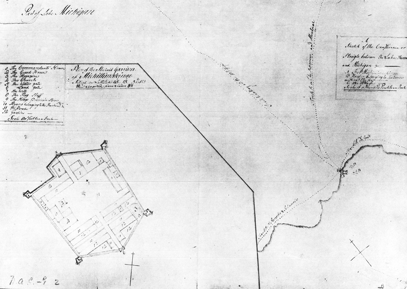


In the 18th century, the summer population of Michilimackinac could swell into the thousands as voyageurs, clerks, merchants, and other French-Canadian, British, and Native American participants in the fur trade descended on the post for the annual trading season. Given the relatively small size of the town inside the fort’s walls, where did all of these people live? By the 1760s, a growing collection of homes sprang up east of the fort, creating the suburbs of Michilimackinac.
After the British took control of Michilimackinac in 1761, an increasing number of civilian merchants and fur traders settled at the post. With little space left inside the fort itself, these new residents built homes to the east of the defensive palisade. By 1778, merchant John Askin wrote that “there is near to one hundred houses in the subarbs, and people are now building tolerable good ones.” The suburbs Askin described likely included a number of rowhouses similar to those built within the fort, and the houses were probably laid out on an organized grid pattern. Although outside the fort wall, the suburbs fell under the jurisdiction of the commanding officer. To ensure that the neighborhood remained clean in 1779, Lieutenant Governor Patrick Sinclair decreed that “the inhabitants and Bourgeois in the suburbs are to forbid their engagés or domestics or servants to throw sweepings, feathers, or nastiness in the streets.” The master of police, Christian Burgy, was likely responsible for enforcing this and other orders throughout the community.
The houses in the suburbs were either abandoned or dismantled when the entire community of Michilimackinac moved to Mackinac Island between 1779 and 1781. In more recent times, archaeologists have worked to locate some of the suburb structures. Although large-scale excavations of the suburbs have not yet taken place, visitors to Michilimackinac today walk through the location of the community when entering the site, as the suburbs were located in the area between the visitor’s center under the Mackinac Bridge and the reconstructed fort.