


“it could not be possible that a sane man would think of transforming a lonely island into a park…”
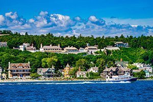
The following article was penned on Mackinac Island by a correspondent of The Detroit Daily Post on June 20, 1875. It was reprinted a month later, on July 24, in Cheboygan’s Northern Tribune. The scenes of Mackinac Island included here are souvenir views published by Adolph Wittemann in 1886.
____________________________
“Last winter when Senator Ferry introduced his bill setting apart the Island of Mackinac for a National Park, many persons at once took it for granted that it could not be possible that a sane man would think of transforming a lonely island into a park, unless he expected it to transport it to some other locality. Even in Michigan this island is supposed to be ‘up north somewhere among the icebergs.’
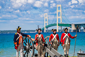
 Let us now briefly glance at this future National Park, and show the reader that it is one of the most inviting spots for the summer tourist that America possesses … Reaching the island, the fort with its whitewashed walls and the old flag floating over it, is the first thing on the programme. This fort is now garrisoned by 32 men under the command of Maj. Dickey. The sentinel pacing his beat, armed with a musket and arrayed in the war dress, and also the cannon peering over the parapet, suggest ravages of war, but the value of Mackinac from a military standpoint consists for the most part in its history.

Leaving Fort Mackinac, a walk north for about half a mile brings us to the ruins of Fort Holmes. This was built by the British during the War of 1812, and was named Fort George by them. When the Americans gained possession of the island they changed it to that of Holmes, in honor of Maj. Holmes, who was killed on the island. Nothing but the ruins of the fort remain, but in addition to the interest that these possess, the view from this spot is a most beautiful one.

Beyond this point toward the northwest part of the island, the visitor finds the following objects of interest: The Soldiers’ Cemetery, located in the woods, is a delightful spot. Then we have the battlefield, at Early’s farm. The old farm-house is itself an interesting affair, but the battlefield is now an orchard. Half a mile farther northwest we reach the British Landing, the point where the English landed during the War of 1812, and marching up the road fought the battle that gave to them the island. Afterward, when the Americans recovered possession, the red-coats marched back to the same spot and embarked in their boats. A strip of beach covered with pebbles marks the landing …
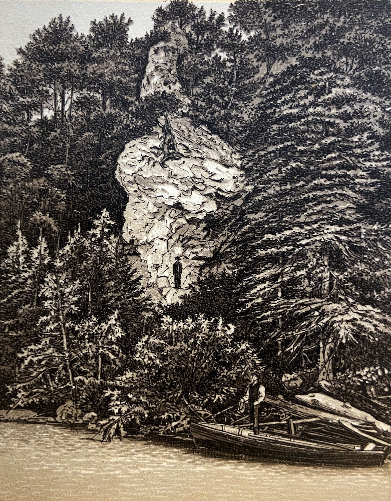
Of the natural scenery, first in order we have the Lover’s Leap, a rock rising from the beach, out from the bluff, about 175 feet high. A very romantic Indian story is connected with this place, and this fact and its grandeur as it stands boldly out like a sentinel guarding the rocky shore, makes it one of the favorites. A short distance west the wonderful Chimney Rock is reached. This is a solid pile [of] brecciated limestone about 110 feet high, shaped somewhat like a chimney as seen from the lake. Prof. Winchell considers it the most interesting rock on the island, and when we study its geological history this appears a well founded opinion.

Descending the bluff to the water’s edge we soon reach the rock called the Devil’s Kitchen. The name refers to a number of openings resembling ovens, and one in the center larger than the others faintly suggests a fire-place. This rock, and in fact there are several interesting ‘pebbles’ in its immediate vicinity that well repay the visitor for his walk along the rugged pathway.
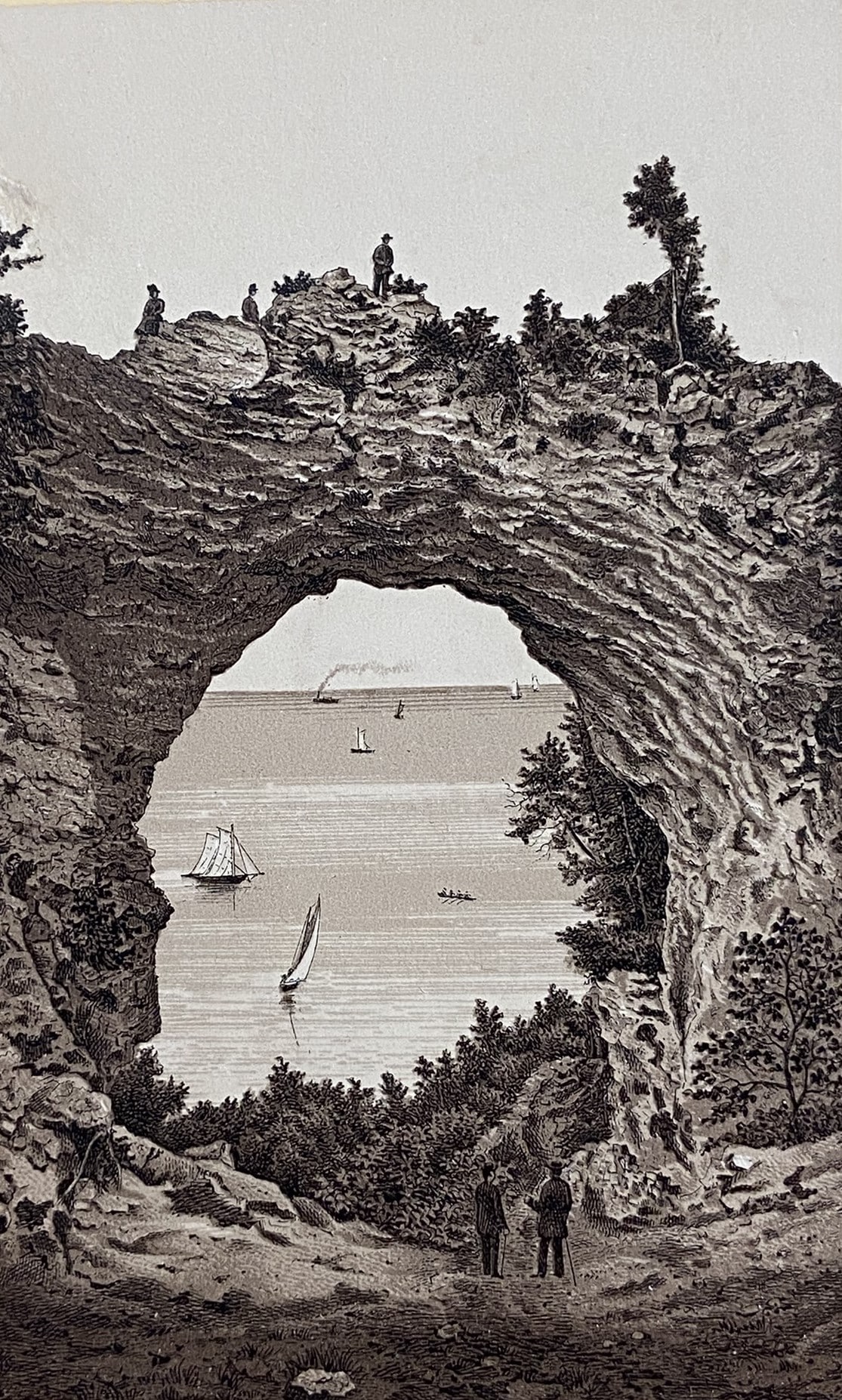
The eastern part of Mackinac merits attention. First in order we have the beautiful Arched Rock. This is 150 feet above Lake Huron, and is an almost perfect arch, with a span of 90 feet. The visitor can reach the summit by a little careful climbing, and sitting on the top of the arch, which is but three feet wide, he has a glorious view of the waters, ships, Bois Blanc Island and the mainland.
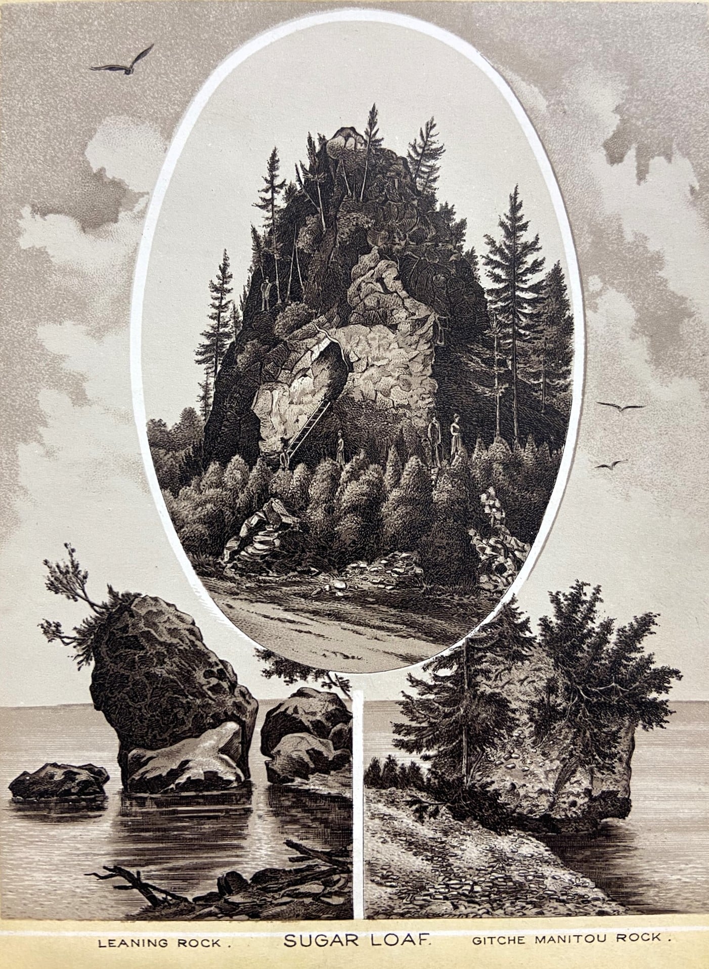
The Giant’s Causeway, a short distance south, is another massive rock that was hurled up from beneath the waters by some convulsion of nature in the days when the world was young. It does resemble a massive stairway leading up from the water to the cliff. Robinson’s Folly, an overhanging rock near the Causeway, was the scene of one Capt. Robinson’s folly, as he erected a house and an arbor on the very brink of the precipice, which becoming effected by the wind and storms, broke off, carrying the arbor with it, nearly 200 feet below. The Sugar Loaf is a pile of limestone rock shaped very much like the traditional sugar-loaf. A few straggling cedars are seen upon it … A grotto in the side of the rock will shelter four persons. The Indian legend says the Manitou, or Great Spirit, emptied the ashes of the peace-pipe here thus forming the rock.
Now, having hurriedly glanced at some of the beauties of Mackinac, we will leave caves, the beautiful drives, the fine trees that cover the island, and above all, the delicious atmosphere, tempered as it is by the presence of the cool waters of Huron, to the visitor’s care, and bid farewell to this beautiful isle of our freshwater seas.”